SEGMENTS AND THEIR MEASURES WORKSHEET
Subscribe to our ▶️ YouTube channel 🔴 for the latest videos, updates, and tips.
Problem 1 :
Measure the length of the segment to the nearest millimeter.

Problem 2 :
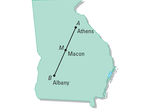
Use the map to find the distances between the three cities that lie on a line.


1. Answer :

Use a metric ruler.
Align one mark of the ruler with A, then estimate the coordinate of B.
For example, if we align A with 3, B appears to align with 5.5 as shown below.

Now, we have
AB = |5.5 - 3| = |2.5| = 2.5
The distance between A and B is 2.5 cm.
Note :
It does not matter, how we place the ruler.
For example, if the ruler in the above example is placed such that A is aligned with 4, then B aligns with 6.5. The difference in the coordinates is same.
That is,
AB = |6.5 - 4| = |2.5| = 2.5
2. Answer :

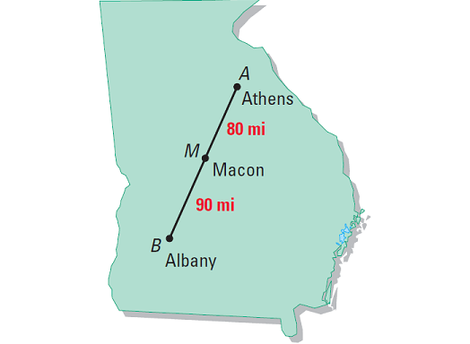
Using the scale on the map, we can estimate that the difference between Athens and Macon is
AM = 80 miles
The distance between Macon and Albany is
MB = 90 miles
It has been explained in the picture given below.

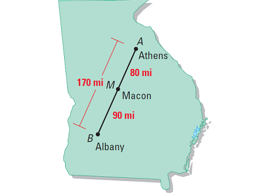
Knowing that Athens, Macon and Albany lie on the same line, we can use the Segment Addition Postulate to conclude that the distance between Athens and Albany is
AB = AM + MB
AB = 80 + 90
AB = 170 miles
It has been explained in the picture given below.

Subscribe to our ▶️ YouTube channel 🔴 for the latest videos, updates, and tips.
Kindly mail your feedback to v4formath@gmail.com
We always appreciate your feedback.
About Us | Contact Us | Privacy Policy
©All rights reserved. onlinemath4all.com

Recent Articles
-
Hard SAT Math Questions with Video Solutions
Feb 02, 26 01:53 AM
Hard SAT Math Questions with Video Solutions -
How to Solve the Hardest SAT Math Problems
Feb 02, 26 01:46 AM
How to Solve the Hardest SAT Math Problems -
10 Hard SAT Math Questions
Feb 02, 26 01:07 AM
10 Hard SAT Math Questions
